Sunday, July 29, 2012

Southern Portion of West Coast of Baranof Island

Wednesday July 25 - Saturday July 28

Pyramid-shaped Mountain is behind Sitka, Baranof Island
We left Sitka and headed down the outside coast of Baranof Island. We had a wonderful weather window: calm seas and light wind (usually on the nose; Urs would have liked more wind from a better angle). Calm seas was important as some stretches would be in the open waters of the Gulf of Alaska. For the first day and a half, we found protection cruising behind a maze of islets and rocks.
Sevenfathom Bay

Our first anchorage was Sevenfathom Cove. It was surrounded by a fairy-tale forest and high mountain peaks with snow patches. We particularly liked the quietness after 6 days in Sitka. We saw an unusual sight: a juvenile bald eagle on a tree with its wings spread out perhaps to dry like cormorants; maybe he had been fishing. Higher up on another tree a raven was sitting and calling loudly.
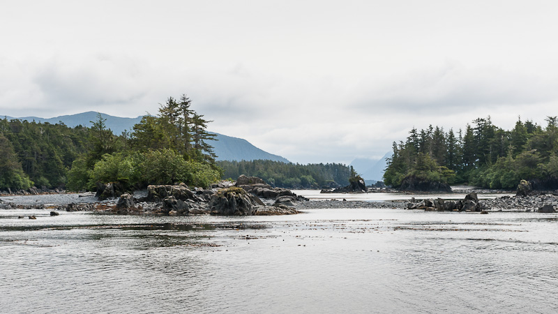
Entrance to Scow Bay

On Thursday, we had a lunch stop in Scow Cove; the entrance was particularly narrow. Then out to open seas for the first time since leaving Sitka. The seas were as good as you could imagine, hardly any swell. The scenery is very interesting and typical of an outer coast. Because of the heavy, continual pounding of surf during storms, nothing has a chance to grow on the rocks; they are bare up to about 150 feet. We anchored in Still Harbor, another beautiful anchorage surrounded by dense forest. The evening's excitement was a loon, flying with partially folded wings to descend rapidly from high above to the water; then she took off with a fish dangling from her beak.
Foggy Morning in Still Harbor

Pea Soup Fog -- There really is land out there;
see instruments below

Friday, started out pea-soup fog and drizzle; we turned on the radar. We had less than half a mile visibility. The radar showed several nearby boats but we could not see them until the fog lifted. On the outside coast, we had to weave our way through a fleet of trolling fishing boats. Packer boats often anchor in nearby harbors, buying fish from the fishermen and then taking the fish to a processing plant, while the fishing boats keep on catching fish.
The Chart Plotter on the Left Shows our Route along the Shore, the Arrow is our Boat;
The Radar on the Right Shows Land About 1.5 Nautical Miles Away

Sun Shining in Puffin Cove
Rainbow at Puffin Cove

We headed up Puffin Inlet and then made a 150-degree turn toward our intended anchorage. The passage appeared so narrow. I said: "We are not going into there, are we???!!" When Urs said, "Yes", I headed to the bow. Puffin Cove turned out to be a lovely spot, big enough for one or two boats. It is surrounded by very steep, high mountains with deep green slopes and snow patches. Eventually the sun came out and a spectacular rainbow appeared. A huge school of herring attracted wildlife. They were jumping in the air on all sides of us. A lone female sea lion spent several hours gorging herself on the fish. Then about 6 bald eagles swooped in to scoop up fish until nightfall.


Bow Digging into Wave
Saturday morning, swells were coming into Puffin Inlet. Outside, the water was very confused: swell from the west and wind-waves from the south. It was an uncomfortable chop; Raven Song dug her bow into a number of the increasingly large swells. We plowed on slowly. Then, we saw lots of birds (puffins, murres, phalaropes, skuas) and realized that the water had suddenly become flat. We don't know what caused the difference -- changing tide? currents? And another question: Apparently male phalaropes incubate the eggs and raise the young; what are the females doing? Do they head south or wait to migrate with the others?
Common Murres

Before rounding Cape Ommaney (he was the provisioner or "victualler" for Capt Cook), we avoided the lines of several commercial fishing boats. We watched some sports fishermen in an anchored skiff; Urs said they were probably fishing for halibut. Later, after we had docked in Port Alexander, a guy stopped and offered us three large pieces of halibut -- he was the skipper of the skiff that had been halibut fishing -- they had been watching us, too! and thought it only appropriate to share their catch. We gave him a Swiss chocolate bar in trade, which he gladly accepted.
Small Troller
Cape Ommaney at Southern Tip of Baranof Island
Cape Ommaney

Coming Into Port Alexander
Entrance to Port Alexander on the Right at Low Water
Problems Anyone?  Or Maybe a Hamburger with the Works?
Fisher Depositing Two Salmon with Float for Us
We walked along Port Alexander's extensive boardwalk. Population is about 40 but many sports fishermen have summer cabins. There is a school; one boy asked if we were the new teachers. Alaska will fund a school if there are at least 10 students; Port Alexander has 14 and the new teacher will be bringing her own 5 -- good news for the school. Of course, we had to visit Laughing Raven Lodge and Problem Corner Cafe, a tiny place that sells an amazing variety of food. There is a cute general store. Then we walked along the beach collecting flowers and rocks. Quite an interesting and quaint place. The people are very friendly. We really enjoyed our stay. Port Alexander was named after Alexander Baranov, the first governor of Russian America.

As I was putting dinner on the table, a small boat, the F/V Anna Louise, was trying to raft up to the boat in front of us. The skipper's dog fell into the water. While he was busy retrieving the dog, his boat floated back with the current bending one of our stanchions. Urs was able to bend it back. He apologized and said he had no money to pay for the damage, but he promised us some fish if we called him on the radio early in the morning.

And as promised, the skipper of F/V Anna Louise responded to Urs's radio call. He was not far away and had some fish. He put two fish into a plastic bag, tied the bag to a bit of floating line with a float. Then, he put it all into the water while trolling past us with all his fishing gear in the water. We retrieved the fish, put a Swiss chocolate bar into a new bag for him. Then he swung around and retrieved his float and the chocolate. He really appreciated it and apologized again for the incident. Salmon for dinner and left-over halibut for lunch!
Laughing Raven Lodge
Float Tree!
Common Harebells
Fishing Boats Unloading onto a Packer

Tuesday, July 24, 2012

Sitka Again

Thursday July 19 to Tuesday July 24

We are moored at Sitka Harbor, a small sailing boat among huge commercial fishing boats.  We have spent most of our time here reprovisioning and fixing things.

Our bear rescuers also arrived.  We had an enjoyable dock party with them.  All the locals commented on the crazy Canucks!

We walked to Swan Lake on a sunny day.  The Russians used the lake to make ice, which they sold in San Francisco.  When the Americans tried to offer a lower price for Alaska, the Russians countered that the lake and its ice was worth a lot.

We belatedly celebrated my birthday at a tiny, gourmet bistro.  It is always fully booked.  We made reservations on Thursday for a Monday sitting!!

We're off southward along the west coast of Baranof Island tomorrow morning.

Outside of Chichagof – Part 4

Wednesday July 18
<><><> 
Piehle Passage with Blue Circles Marking the Waypoints
We got up early to go through a narrow, rocky passage at low water in order to see more of the rocks. Then we cruised in open waters of the Gulf of Alaska until we reached Kalinin Bay on Kruzof Island.

What Bears are Supposed to do when they see Humans
We had heard there was a hike to Sea Lion Beach on the outer side of the island.  We stopped by Northern Wanderer, the boat that had been in the same anchorage and whom we had followed through the rocky passage.  Larry told us to expect to see bears and we said we did.  We left at 3, not knowing how long the hike would be.  There were only boot prints in the mud at the beginning of the trail; that was reassuring.  However, within 10 meters, we saw relatively fresh bear scat and then more and then more.   We walked along an estuary and saw about 7 bears on the other side; they bolted into the forest as soon as they saw us.

Lake on Sea Lion Cove Walk
Then the trail went through a mature Sitka spruce forest.  We talked loudly and blew our whistles to prevent any bears from being surprised by our appearance.  The trail went up a pass and became a boardwalk over a bog – more scat on the boardwalk but no prints in the mud.  Urs stopped to take lots of pictures; I observed the flowers.  Then we came to a lake with lots of deer prints in the sand.  We’d been walking about an hour and both started to wonder how much farther it was to Sea Lion Cove. Another 45 minutes and we finally reached the outer coast.  It was a beautiful, wild, sandy beach with breaking waves.  The sun was out and so were the black flies.  We sat down for some water and crackers and then turned back.
[More after pictures.]
Boardwalk through the Bog
Water Lily
Water Lily Pond
Sea Lion Cove
E
Alaska Violet
White Bog Orchid
Back at the estuary we saw 7 grizzly bears, which immediately ran away. Shortly before we reached our dinghy, we saw two bears, between us and the dinghy. These two were apparently 2- or 3-year olds. They did not run away. Urs took some pictures. They still kept on feeding on the grass. We talked loudly and whistled. They still didn’t leave. We heard Larry blow his boat’s horn, either to warn us or to scare the bears. They still didn’t go. We saw Larry and Bill from another boat coming toward us in their dinghy. Bill blew his air horn. The bears only looked curious. Finally, Larry fired his rifle. Then the bears ran into the forest. When we walked along the trail, we could hear them huffing and could see them – that was the scary part.

We finally got back to the boat much later than we had planned. We were tired and covered in bug bites.
No Evidence of Human Remains in Scat
Bears Calmly Grazing between Us and Our Dinghy
Was that an air horn?!! - Raven Song in the Background


The Chart is wrong!!! Outside Chichagof -- Part 3

Tuesday 17 July (written by Urs)

We waited until high-water slack before leaving Lake Anna.  Judy was uneasy about going back into the Gulf of Alaska because we had not been able to receive weather forecasts and because the wind was relatively strong.  But it was no problem. We first wanted to go to Waterfall Cove, a beautiful anchorage with a spectacular waterfall and nice bear-friendly grassy flats. However, we found it very tight and the wind was blowing strongly into the anchorage. What really scared us off was also the fact that the chart did not seem correct. The GPS showed us very close to land when we knew we were in the middle of the space between the two sides and chart depths didn’t match what our instruments read. We were already well anchored when we decided to abandon the spot, and go on to nearby Falcon Arm, a side bay to Slocum Arm and behind the Khaz Peninsula.

Black arrow shows where we are on the chart.
Cross in middle of bay is where we were
For Falcon Arm, our guidebook talked about a rock in the middle of the outer bay being shown incorrectly on some older charts. This was corrected in all three of our charts, one paper and two digital. They should be correct since they have only recently been downloaded from NOAA, the US marine chart authority!

At center left is the rock which was 350 meters away
However, when we were deeper into the bay and close to the tip of a peninsula, the GPS showed us still quite a ways off. Something was clearly wrong here too but the discrepancy was larger. We proceeded cautiously into the inner bay by sight and depth sounder and bow watch, ignoring the GPS position shown on both of the two independent plotters. Visually, we were anchored in the middle of the bay; however, the GPS digital charts had us sitting on top of a rock at the entrance to the bay, some 385 yards away (350 meters)!!! This is an example of the chart being clearly wrong relative to the GPS position. I also checked the chart to see what horizontal chart datum (a base line position reference for charts) had been used. The chart says they used NAD83, which is practically equivalent to WGS84. Our GPSs are set to WGS84, hence, we are talking the same language, and the chart and GPS should be in synch. I conclude that the chart is just clearly wrong!!!

We have learned a long time ago that one must always be alert and consider all the inputs. The following text is printed on the chart in red: "The prudent mariner will not rely solely on any single aid to navigation ...."

So much for the excitement of the day.

Outside Chichagof Island Part 2

Sunday July 15 – Monday July 16

July 15
Elbow  Passage to Klag Bay
We anchored at Klag Harbor after a very intricate passage with many narrow and zig-zag channels. We explored the gold and silver mine site that closed in 1943.  From 1905 to 1943, $13,000,000 worth of minerals was extracted from the mine.  Urs took many pictures of old rusty equipment and collapsed houses. I collected stuff: rusty nails, some kind of pottery used presumably for some technical purpose, and foxglove.  The gold mine was like an outdoor museum of rusted electrical and mechanical equipment:  frayed cable on a winch; a motor that Urs identified as electric; rock crushers and separators; umpteen similar metal boxes that might have housed switches or dynamite or …  And then there was daily life:  a series of tiny collapsed cabins with some paint still on the walls and electrical wiring; shards from dishes; lots of nicely embossed radiators for heating the cabins; glass jars with unidentifiable, no-longer-edible contents.  I wondered where they ate and washed.  A tin hardhat or cooking pot was in the intertidal waters.
 No bears but the salmon are gathering and jumping.
Historical Photograph of Chichagof Village and Gold Mine
Chicagof Village Today

Pretty Rusty!
Dinghy Safely on High Ground
Rusting Heating Radiator
Sea Otter
Rusting Cable
Foxglove
Old Boiler
Ground Cone (Grizzlies Gorge on this)
Shovel
Red Necked Loon
Rusted Electric Motor

July 16


Lake Anna
Near Klag Harbor is Lake Anna, where we anchored at a river mouth.  This is not really a lake, but it is a fairly isolated body of water with a narrow entrance and strong eddies and currents.  Sister Lake is a large lagoon that empties into Lake Anna with a 12-knot current on the ebb tide.
Urs worked all morning to fix the heater. The heater is important in this 10 C (52 F) weather. It seems to work again fine now. Time will tell. Heavy drizzle. We took the dinghy for an exploring ride.